The Legends of Lake Belle Taine
This section is a work in progress.
The more time you spend in the Park Rapids and Nevis areas, - and on Lake Belle Taine -, the more you hear and learn the stories and legends that define this area and the local culture.

Northern Minnesota's early culture was largely defined by independent living in a remote wilderness, - lakes and rivers, hunting and fishing, logging and lumber mills. Beginning in the early 1900s, tourism played an essential role in the local economy, as family resorts attracted an influx of new visitors each week and local businesses focused energies on the visitors. As visitors returned for their annual week at the resort, a Minnesota culture developed in the common resort experiences, - the annual retreat, the family time, the lakes, fishing, and swimming, the familiar businesses, restaurants, and attractions. In the later 1900s, as the resort owners grew tired and began selling their cabins to individual owners, and larger lake properties were subdivided to enable additional lake homes, a weekend-retreat culture surfaced. Even though the Park Rapids census population is about 4,000, the area draws nearly ten times that number, many who come to the Park Rapids lakes region each weekend to escape their work life elsewhere.
The Explorers
The Dakota natives first settled this area long ago, but as the Ojibwe moved westward when the Europeans began settling the east coast, the Dakota were pushed further south and west. The Ojibwe became the primary trading partners to the French fur traders, as they began establishing trading posts throughout the Minnesota and Wisconsin lakes regions. Of course, native history deserves more than two sentences, so please visit the Minnesota Historical Society website for more history on the Dakota and Ojibwe.
The Mississippi Headwaters region was an early draw for French fur traders, as well as early European settlers. The earliest explorers of the new world ventured into the northen reaches of the Mississippi, and presumably the Park Rapids region.
As the fur trade dwindled in the early 1800s, and Europeans moved into Minnesota, the logging economy and tourism provided fuel for northern Minnesota. The expansion of the railroads and the Homestead Act drove further development.
Frank C. Rice was one of the earliest settlers to Park Rapids. The original town site was established in 1879 by C.O. Charles
Todd, who claimed the location via the Homestead Act and built his log claim shanty
near the intersection of today's First Street and Main Street. Todd soon relinquished the claim to Frank Rice and his brother Gilbert. In 1881, the Rice brothers established a lumber mill at the site on the Fish Hook River, and dammed the river to capture hydro power for the mill. Also in 1881, Frank Rice conducted the first Independence Day celebration in the area, and announced at the event that Park Rapids
would be the town's name. Rice was appointed the first post master for Park Rapids in 1882, and named Register of Deeds in 1883. Rice was also a founding member of the Wadena and Park Rapids Railway Company, which ultimately extended Northern Pacific rail access from Wadena to Park Rapids in 1891.

Click image to see
the full Northern Pacific map
Rail lines were a major catalyst of expansion through and within Minnesota, with the Northern Pacific line running through Brainerd and Wadena by 1872. The 1891 rail expansion between Wadena and Park Rapids was financed by Frank Rice's Wadena and Park Rapids Railway Company. The Great Northern Railroad later claimed the Northen Pacific and Park Rapids routes. Click here to learn more about the various railroad companies that popped-up in Minnesota.
Resort life was made possible by the earlier explorers and those who built the means of transportation to the Park Rapids area.
Where Does That Name Come From?
Though our lake was named Elbow Lake in the late 1800s, likely because of its shape, the name was corrected to its native name in 1919. Mahlon Black's 1870 survey team recorded numerous times in their field notes the lake's native name Lake Belle Tain
. Black's team often referenced the Crow Wing River south of Belle Taine, indicating the team was aware of the native names of lakes and rivers. The filed notes left little doubt that natives and locals of the time had adopted the name Lake Belle Taine.

Given the French term belle tain
, which means beautiful foil, - or perhaps beautiful mirror, beautiful reflection -, the name likely originated back in the earlier French fur-trading days.
The following 1954 explanation by Wallace J. Schutz helps explain the name correction from Elbow to Lake Belle Taine:
The 1870 survey notes where the name
Lake Belle-Taine is first referenced.

The 1870 survey notes where the name
Lake Belle-Taine is referenced.

- No doubt many tourists coming to spend a few weeks on the shores of beautiful Lake Belle Taine wonder what the name of the lake really means. A number of people have asked me about it, which has led me to write a brief explanation for all to read.
- The first written record of the name, Belle Taine, is found in the survey notes made by Mahlon Black, deputy surveyor, who surveyed Nevis Township in the fall of 1870. Black used this name in reference to the lake as they surveyed its shores.
- Back in 1919 Grover Conzet, a former resident of Nevis and the later director of the State forestry service, was going through these old survey notes, and came across the name Belle Taine. At that time Belle Taine was called Elbow Lake and as there were a number of Elbow Lakes in the State, it was very confusing.
- As all know, -Belle- in French means beautiful, and according to French dictionary the French word - etain - means tin and the word - tain - means silvering or foil. In the early days of the French fur traders, tin mirrors were a common article of trade with the Indians.
- No doubt these traders upon seeing our lovely lake thought it as a - beautiful mirror -, and now that Belle Taine is back to its old and higher level, we can easily see why they gave it this name. Belle Taine has also had a number of other names during the past 150 years. The native name for the lake meant - the lake into which the river pitches and ceases to flow. On U.I. Nicollet’s excellent map of 1836, Belle Taine is called Lake of the Isles. In the early pioneer days it received the name Elbow Lake. All in all Belle Taine has had more names than any lake in the region, but we hope this one sticks.
Surveying the Region
Survey notes and maps from 150 years ago offer a glimpse into what explorers first saw and how they learned about the area. As the surveyors walked through the various sections in the survey, they noted the tree coverage and distances from landmarks. As they observed and recorded the areas around Lake Belle Taine, it is easy to envision the landscape before roads and houses.
In the general reference pages of those 1870 survey field notes, Black's team noted that Lake Belle Taine was the largest lake in the area, that a large stream flowed into the lake from the northwest, and that there was no outlet from the lake. They also made the observation the water in lake [Belle Taine] is clear and pure
, which is a characteristic of Lake Belle Taine we appreciate yet today.
Black platted on the 1870 survey the original White Earth Wagon Road that connected Leech Lake with the White Earth Reservation, and preceeded County 80 along the scenic southern shoreline of Lake Belle Taine.

Page 40 of the 1870 survey notes
where it appears the team wrote then erased the name.
On page 40 of the 1870 survey notes, it appears the team wrote the name Lake Belle Taine, and then erased it. On page 52 and 53, the team recorded the full name Lake Belle-Taine.
Why was the name erased on page 40?
The surveyors often referenced the Crow Wing River in their notes, which indicates that name was common to the natives and locals. The surveyors used the name Lake Belle Taine in their notes, but the lake was later given the European name Elbow.
Why?
For his 1920 book Minnesota Geographical Names - Their Origin and Historic Significance, Archaeologist Warren Upham interviewed several early settlers to the area and recorded the following history behind the local names:
- Elbow lake [now Lake Belle Taine], was named ... for its sharply bent outlines, and has an Ojibway name which means, ... the lake into which the river pitches and ceases to flow. [Lake Belle Taine] has no visible outlet, the inflow being discharged south to the Crow Wing river by springs, or perhaps westward to the north part of Long lake in Henrietta and Hubbard townships.
- Nevis township and its railway village were probably named for Ben Nevis in western Scotland, the highest mountain of Great Britain.
- Park Rapids was named by Frank C. Rice, proprietor of the townsite, who came from Riceville, Iowa, the railway village he previously platted. The name was suggested due to the park-like groves and prairies laying beside the rapids of the Fish Hook River, which were later dammed to supply valuable hydro power.
- Peter Turnbull, a land surveyor and civil engineer from Canada, opened the northern part of the wagon road from Park Rapids to Itasca in 1883.
- Akeley township and its railway village were named in honor of Healy Cady Akeley, who built large sawmills in the area, and for many years engaged extensively in the logging and manufacture of lumber.
The characteristics that describe a lake often help name the lake. It is amusing that local Potato Lake looks like a fish hook, and Fish Hook Lake looks like a potato. Both lakes are on the Fish Hook Chain of Lakes. It is easy to understand how names, labels, and notes from decades or centuries ago can get lost in time.
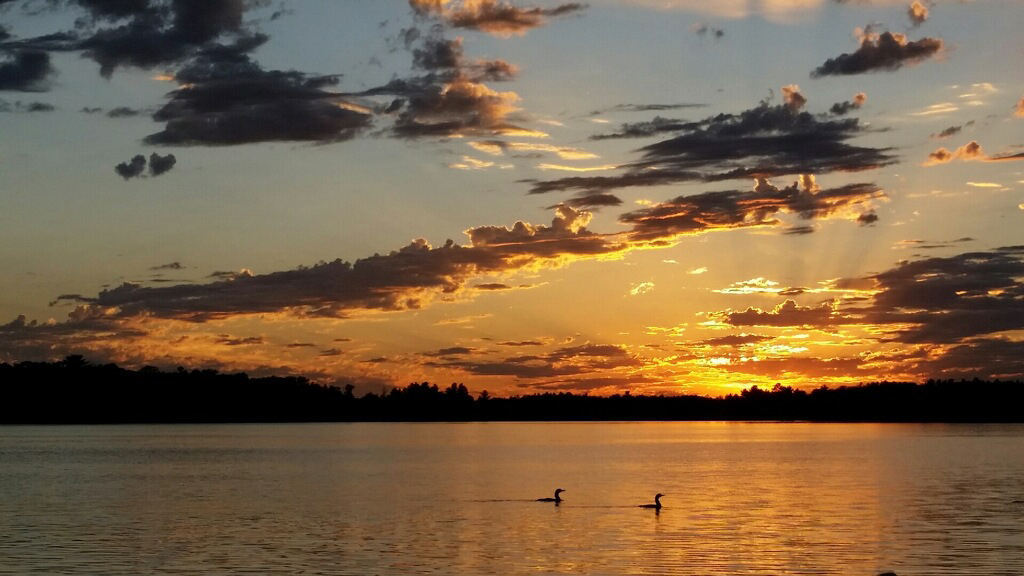
Beautiful mirror, or Belle Taine, perfectly describes and names our lake.
Finding Lake Belle Taine
Although the natives and locals had great respect for Lake Belle Taine
and its beautiful reflection
, it wasn't until after the 1870 survey that our lake reliably showed up on maps. Both Lake Itasca and Leech Lake were depicted and labeled on the earliest maps, and some early maps even plotted and named Fish Hook Lake north of Park Rapids. Two 1840's era maps depicted a mysterious Lake of the Isles
in a similar location to Belle Taine, but this 1873 map was likely the first to accurately depict Lake Belle Taine for all to see.

Joseph Nicollet's 1845 map of his
1836-1838 Mississippi Expedition
Lake Belle Taine did not reliably show up on maps until after the 1870 survey, but it is fun to look back at the various maps that loosely defined the area during early exploration.
Two of the earliest maps of the region include Joseph Nicollet's map of his 1836-1838 upper Mississippi region expedition, as well as J.H. Colton and Co's 1860 map of Minnesota and the Dakotas, which outlines the US expansion at the time. Both of these maps depict a Lake of the Isles
in a similar location as Lake Belle Taine.
Early Maps of the Region
Click images to View Sources
-
John Pope's 1849 Expedition Map

-
J.H. Colton and Co's 1860 map
depicting Lake of the Isles
-
1873 Map of Minnesota, accurately representing area lakes including Lake Belle Taine.

-
1880 Township and Railroad Map of Minnesota

-
1889 Rand, McNally and Co. Map of Minnesota

On the 1849 map that documented Captain John Pope's expedition through Minnesota, a series of lakes in the region were depicted and connected by rivers. Lake of the Isles
and Fishline
lakes are drawn, and also chains of lakes that can reasonably appear like the Crow Wing chain and the Mantrap chains, with a Lake Pele
at the southwest junction. Lake Belle Taine can appear like a junction of the Mantrap and Crow Wing chains.
It's clear that the 1870 survey data was used to accurately depict Belle Taine and others lakes on the 1873 map commissioned by the 1867 Congress and produced by Colton and Co. of New York.
An 1880 Township and Railroad map clearly plotted Lake Belle Taine in the region, but no Crow Wing or Mantrap chains. This map also depicts Long Lake east of the Park Rapids area and names Frish Hook
Lake north of the Park Rapids area.
An 1889 Rand, McNally and Co. map plotted Lake Belle Taine, without a name label, and depicted and named Fish Hook Lake north of Park Rapids. The Crow Wing Chain is not shown. This map is interesting because it labels the towns and settlements of the area, including Henrietta on the west of Belle Taine and Ojibway
to the east.
Belle Taine's Changing Water Levels
There is no obvious river or stream outlet from Lake Belle Taine. Some long-time residents claim that a narrow stream originally ran between Belle Taine and the Crow Wing chain, which was collapsed during construction of Highway 34. However, the 1870 survey team found no evidence of a surface outlet, and the early Ojibwe even called the lake Gaa-aachaajigwaatigweyaag zaaga'igan
, which means the lake into which the river pitches but ceases to flow.
This study explains the magic of a lake into which a river pitches but ceases to flow. According to the research, there is an unsaturated layer of glacial sediments [sand and gravel] below the bed of Lake Belle Taine, but above the underground water table [aquifer], which allows the lake's water to seep/drain into the layer below the lake. The seepage from the lake is greater along the southern shoreline than the northern shoreline. Additionally, a survey of well depths in the area show the water table along the southern shoreline is significantly deeper than Belle Taine's lake bed, which helps support the findings that Belle Taine's water seeps into an unsaturated layer of sediment below the southern lake bed. Because the nearby Crow Wing lake levels are several meters below Belle Taine, some of the lake's water is assumed to filter through the sediments into the nearby Crow Wing lakes.
The study helps explain how the normal inflows of water from the Sand Creek are essentially balanced by the seepage into the underground layer. During times of increased precipitation, the lake level will rise until the excess water naturally seeps into the ground layer below the lake. According to the DNR and other sources, the Mantrap chain and Belle Taine are partially spring-fed. High water levels that lag years of heavy precipitation are likely because the ground-water tables become saturated and leave no more space for the natural seepage into the ground.
Having no outlet, Belle Taine water levels do fluctuate a couple feet each year, and some years, the high water levels cover sand beaches and encroach residents' shore lines. Although some lakeshore owners have cried for a man-made drainage system to regulate water levels, the lake level eventually and naturally returns to more-normal levels after a season or two. Long-time residents claim Lake Belle Taine cycles between high and low water levels about every 20-years, and many tell stories of water levels much higher or lower than current levels.
We Owe it All to the Glacier
According to a 1965 report by Don Reedstrom for the Department of Natural Resources, Belle Taine sits with other area lakes in the Mantrap Valley Watershed, an area of glacial remains formed as the Wadena lobe of the late Wisconsin glacier receded around 12,000 years ago.
The soil and grade in the region surrounding Lake Belle Taine consists largely of sand and gravel, which allows for good drainage and water filtration, resulting in beautiful water clarity in the region's lakes.